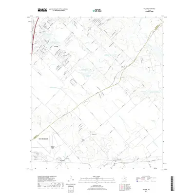
2019 Map of Uhland
USGS Topo · Published 2019About this map
Kyle and Uhland anchor this Central Texas landscape as it appeared in the late 2010s, a period of notable residential expansion along the corridor between San Marcos and Austin. The map details a transition from the structured residential blocks of San Marcos near the San Marcos Regional Airport to the rural expanses of the Hays and Caldwell county line. Water management is a defining characteristic of the terrain, with numerous drainage and storage features such as Soil Conservation Service Site 4 Reservoir and the M D Heatly Reservoir regulating the flow of Plum Cr and its tributaries.
Find a feature on this map
146 named features on this map. Tap any name to fly to it.
Don’t see what you’re looking for? This feature index may not catch every label — zoom into the map to look around manually.
Map Details
Editions of this 2019 Uhland Map
This is the sole edition of this map. No revisions or reprints were ever made.
Other maps of this area

1896 · Austin
USGS Topo · 1:125,000

1897 · Austin
USGS Topo · 1:125,000

1910 · Austin
USGS Topo · 1:125,000

1911 · San Marcos
USGS Topo · 1:125,000

1919 · San Marcos
USGS Topo · 1:125,000

1930 · Lockhart
USGS Topo · 1:62,500

1953 · Seguin
USGS Topo · 1:250,000

1954 · Austin
USGS Topo · 1:250,000

1955 · Montopolis
USGS Topo · 1:62,500

1958 · Seguin
USGS Topo · 1:250,000