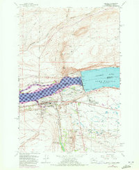
1962 Map of Umatilla
USGS Topo · Published 1972About this map
McNary Dam stands as the central engineering marvel of this landscape, bifurcating the Columbia River and creating the distinct water levels of Lake Wallula and Lake Umatilla. The complex industrial and social infrastructure supporting the dam is evident in features like the Powerhouse, Fish Viewing Station, and the nearby residential settlement of McNary. To the south, the city of Umatilla serves as a hub of transportation and commerce, where the Union Pacific railroad and the Umatilla River meet the larger Columbia.
Find a feature on this map
47 named features on this map. Tap any name to fly to it.
Don’t see what you’re looking for? This feature index may not catch every label — zoom into the map to look around manually.
Map Details
Editions of this 1962 Umatilla Map
4 editions found

Other maps of this area

1908 · Umatilla
USGS Topo · 1:125,000

1917 · Pasco
USGS Topo · 1:125,000

1953 · Pendleton
USGS Topo · 1:250,000

1953 · Walla Walla
USGS Topo · 1:250,000

1956 · Pendleton
USGS Topo · 1:250,000

1958 · Walla Walla
USGS Topo · 1:250,000

1962 · Hat Rock
USGS Topo · 1:24,000

1962 · Stanfield
USGS Topo · 1:24,000

1962 · Ordnance
USGS Topo · 1:24,000

1962 · Hermiston
USGS Topo · 1:24,000