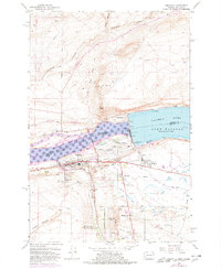
1962 Map of Umatilla
USGS Topo · Published 1978About this map
McNary Dam dominates this section of the Columbia River, separating Lake Umatilla from Lake Wallula. The map details a complex landscape of mid-century infrastructure and desert irrigation, including the Threemile Falls Diversion Works and an extensive network of canals like the West Extension Irrigation Canal and Brownlee Ditch. On the Oregon shore, the town of Umatilla and its newer satellite communities like Power City and McNary are linked by the Union Pacific railroad and the Umatilla Toll Bridge leading across to Plymouth, Washington. Notable local landmarks include the New City Cem, the Rodeo Grounds, and several historic routes such as the Yakima Wagon Road and Umatilla Trail, which contrast with the industrial presence of the Powerhouse and Fish Viewing Station at the dam site.
Find a feature on this map
49 named features on this map. Tap any name to fly to it.
Don’t see what you’re looking for? This feature index may not catch every label — zoom into the map to look around manually.
Map Details
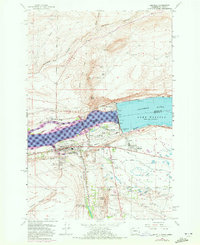
Editions of this 1962 Umatilla Map
4 editions found

Other maps of this area

1908 · Umatilla
USGS Topo · 1:125,000

1917 · Pasco
USGS Topo · 1:125,000

1953 · Pendleton
USGS Topo · 1:250,000

1953 · Walla Walla
USGS Topo · 1:250,000

1956 · Pendleton
USGS Topo · 1:250,000

1958 · Walla Walla
USGS Topo · 1:250,000

1962 · Hat Rock
USGS Topo · 1:24,000

1962 · Stanfield
USGS Topo · 1:24,000

1962 · Ordnance
USGS Topo · 1:24,000

1962 · Hermiston
USGS Topo · 1:24,000