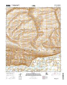
2016 Map of Umiat B-4 NE
USGS Topo · Published 2016About this map
The Colville River carves a massive, braided path across the southern portion of this Arctic landscape, defining the local geography. Rising above the northern bank, Shivugak Bluff and Umiat Mtn serve as significant landmarks overlooking the water’s edge. This 2016 survey documents the shifting hydrography of the region, where Henry Cr and Bearpaw Cr drain into the primary river valley. Near the base of the mountain, Umiat Lake sits within the floodplain, illustrating the complex wetland and riparian systems of the North Slope. The terrain is characterized by detailed contouring that reveals the drainage patterns of the tundra as it slopes toward the river basin.
Find a feature on this map
12 named features on this map. Tap any name to fly to it.
Don’t see what you’re looking for? This feature index may not catch every label — zoom into the map to look around manually.
Map Details
Editions of this 2016 Umiat B-4 NE Map
This is the sole edition of this map. No revisions or reprints were ever made.
Other maps of this area

1952 · Umiat
USGS Topo · 1:250,000

1955 · Umiat B-4
USGS Topo · 1:63,360

1955 · Umiat C-4
USGS Topo · 1:63,360

1955 · Umiat C-3
USGS Topo · 1:63,360

1955 · Umiat B-3
USGS Topo · 1:63,360

1956 · Umiat
USGS Topo · 1:250,000

1964 · Umiat
USGS Topo · 1:250,000
2013 · Umiat C-4 SE
USGS Topo · 1:25,000
2013 · Umiat C-3 SW
USGS Topo · 1:25,000
2013 · Umiat B-3 NW
USGS Topo · 1:25,000