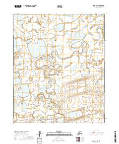
2017 Map of Umiat C-2 NW
USGS Topo · Published 2017About this map
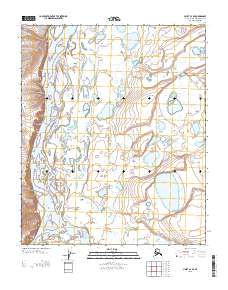
The Itkillik River meanders across the tundra of the North Slope Borough, a defining hydrological feature in this arctic landscape. This region, documented in 2017, showcases the intricate natural drainage patterns and the varied terrain of Northern Alaska. Central to this area is Shirukak Lake, a significant body of water that stands out against the surrounding wetlands and permafrost. The map captures the course of the Itkillik River as it traverses the expansive plains, providing essential data for those studying the geomorphology of the Arctic. Without permanent settlements or roads, the topography focuses on the relationship between water and land. It offers a precise record of the environmental conditions and natural landmarks of the North Slope, allowing for a detailed examination of the area's physical geography during this period.
Find a feature on this map
8 named features on this map. Tap any name to fly to it.
Don’t see what you’re looking for? This feature index may not catch every label — zoom into the map to look around manually.
Map Details
Editions of this 2017 Umiat C-2 NW Map
This is the sole edition of this map. No revisions or reprints were ever made.
Other maps of this area

1952 · Umiat
USGS Topo · 1:250,000

1955 · Umiat D-2
USGS Topo · 1:63,360

1955 · Umiat D-3
USGS Topo · 1:63,360

1955 · Umiat C-3
USGS Topo · 1:63,360

1956 · Umiat
USGS Topo · 1:250,000

1964 · Umiat
USGS Topo · 1:250,000
1971 · Umiat C-2
USGS Topo · 1:63,360
2013 · Umiat D-2 SW
USGS Topo · 1:25,000
2013 · Umiat D-3 SE
USGS Topo · 1:25,000
2013 · Umiat C-3 SE
USGS Topo · 1:25,000