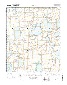
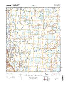
2013 Map of Umiat D-2 SW
USGS Topo · Published 2013About this map
The northern reaches of the Alaska North Slope are documented in this 2013 topographic survey, specifically focusing on the grid of Township 5 and 6 North across Ranges 4 and 5 East. The map is defined by a complex mosaic of thaw lakes and interconnected water bodies characteristic of the permafrost-laden Arctic tundra. Unlike maps of more developed regions, this sheet contains no named man-made landmarks, schools, or settlements, serving instead as a detailed study of the shifting hydrography and elevation contours in a landscape where the natural geography is the only point of reference. Researchers and surveyors can trace the precise boundaries between T 6 N and T 5 N, providing a clear view of the Public Land Survey System layout in a remote environment where very few features have been officially named or recorded.
Find a feature on this map
2 named features on this map. Tap any name to fly to it.
Don’t see what you’re looking for? This feature index may not catch every label — zoom into the map to look around manually.
Map Details
Editions of this 2013 Umiat D-2 SW Map
This is the sole edition of this map. No revisions or reprints were ever made.
Other maps of this area

1952 · Umiat
USGS Topo · 1:250,000

1955 · Umiat D-2
USGS Topo · 1:63,360

1955 · Umiat D-3
USGS Topo · 1:63,360

1955 · Umiat C-3
USGS Topo · 1:63,360

1956 · Umiat
USGS Topo · 1:250,000

1964 · Umiat
USGS Topo · 1:250,000
1971 · Umiat C-2
USGS Topo · 1:63,360
2013 · Umiat D-3 SE
USGS Topo · 1:25,000
2013 · Umiat D-3 NE
USGS Topo · 1:25,000
2013 · Umiat C-3 NE
USGS Topo · 1:25,000