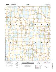
2015 Map of Umiat D-2 NW
USGS Topo · Published 2015About this map
The Itkillik River winds through the eastern edge of this North Slope landscape, defining a remote Arctic terrain dominated by thermokarst lakes and tundra wetlands. This 2015 survey, compiled from imagery provided by the Alaska Dept. of Transportation and BLM, reflects the stark, unpopulated character of the Alaskan interior south of the Harrison Bay coast. The map illustrates a dense concentration of water bodies of varying sizes, indicating a landscape heavily influenced by permafrost processes. While the region lacks formal settlements or infrastructure, the mapping of township boundaries like t7n r5e and t8n r4e provides a precise grid for land management and environmental study in this northern environment.
Find a feature on this map
7 named features on this map. Tap any name to fly to it.
Don’t see what you’re looking for? This feature index may not catch every label — zoom into the map to look around manually.
Map Details
Editions of this 2015 Umiat D-2 NW Map
This is the sole edition of this map. No revisions or reprints were ever made.
Other maps of this area

1951 · Harrison Bay
USGS Topo · 1:250,000

1952 · Umiat
USGS Topo · 1:250,000

1955 · Harrison Bay
USGS Topo · 1:250,000

1955 · Umiat D-2
USGS Topo · 1:63,360

1955 · Harrison Bay A-2
USGS Topo · 1:63,360

1955 · Harrison Bay A-3
USGS Topo · 1:63,360

1955 · Umiat D-3
USGS Topo · 1:63,360

1956 · Umiat
USGS Topo · 1:250,000

1964 · Umiat
USGS Topo · 1:250,000
2013 · Umiat D-2 SW
USGS Topo · 1:25,000