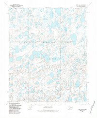
1955 Map of Umiat D-4
USGS Topo · Published 1986About this map
The National Petroleum Reserve in Alaska dominates this 1955 survey of the North Slope, revealing a landscape defined by an intricate network of lakes, ponds, and wetlands. This remote Arctic terrain is bisected by the Kikiakrorak River, which winds northward through the tundra. The presence of the Winter Trail in the southern portion of the map indicates the seasonal nature of transportation and access in this region before the development of permanent infrastructure. The map also establishes the Umiat Principal Meridian, a critical surveying line for the administration of public lands in Northern Alaska. This document captures the wilderness state of the North Slope during the mid-fifties, just as the strategic importance of the petroleum reserve was being formalized for national resource management.
Find a feature on this map
4 named features on this map. Tap any name to fly to it.
Don’t see what you’re looking for? This feature index may not catch every label — zoom into the map to look around manually.
Map Details
Editions of this 1955 Umiat D-4 Map
2 editions found
Other maps of this area

1951 · Harrison Bay
USGS Topo · 1:250,000

1952 · Umiat
USGS Topo · 1:250,000

1955 · Harrison Bay
USGS Topo · 1:250,000

1955 · Harrison Bay A-4
USGS Topo · 1:63,360

1955 · Harrison Bay A-5
USGS Topo · 1:63,360

1955 · Harrison Bay A-3
USGS Topo · 1:63,360

1955 · Umiat C-4
USGS Topo · 1:63,360

1955 · Umiat D-3
USGS Topo · 1:63,360
1955 · Umiat D-5
USGS Topo · 1:63,360
1955 · Umiat D-4
USGS Topo · 1:63,360