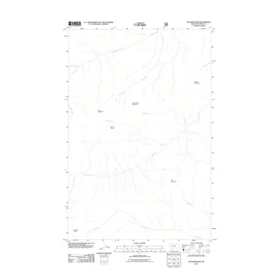
2011 Map of Una Mountain
USGS Topo · Published 2011About this map
Una Mountain and Bullet Nose Mountain dominate this corner of Powell County, where the landscape is defined by high peaks and an intricate network of drainages. The topography is characterized by deep basins and high ridges, notably Nannie Basin which sits between the headwaters of Gabe Creek and Gordon Creek. This 2011 survey documents a wild Montana terrain where no major settlements or roads are indicated, illustrating a preserved wilderness state. To the south, Cardinal Peak and the flows of Cabin Creek mark the lower boundary of the quadrangle, while Butcher Mountain stands to the northeast. The distribution of named drainages like Kid Creek and Bartlett Creek suggests a complex watershed system that has long influenced the accessibility of these mountain ranges.
Find a feature on this map
16 named features on this map. Tap any name to fly to it.
Don’t see what you’re looking for? This feature index may not catch every label — zoom into the map to look around manually.
Map Details
Editions of this 2011 Una Mountain Map
This is the sole edition of this map. No revisions or reprints were ever made.
Other maps of this area

1902 · Ovando
USGS Topo · 1:125,000

1905 · Ovando
USGS Topo · 1:125,000

1936 · Silvertip
USGS Topo · 1:96,000

1942 · Silvertip
USGS Topo · 1:125,000

1955 · Choteau
USGS Topo · 1:250,000

1957 · Choteau
USGS Topo · 1:250,000

1958 · Choteau
USGS Topo · 1:250,000

1962 · Choteau
USGS Topo · 1:250,000
1970 · Crimson Peak
USGS Topo · 1:24,000

1970 · Big Salmon Lake East
USGS Topo · 1:24,000