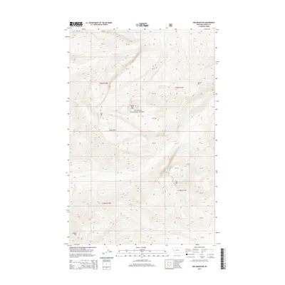
2014 Map of Una Mountain
USGS Topo · Published 2014About this map
Flathead National Forest land defines this mountain landscape in Powell and Montana counties, centered on a series of prominent peaks and high-elevation basins. Una Mtn and the neighboring Bullet Nose Mtn rise above Nannie Basin, which serves as a natural collector for alpine drainage. The terrain is marked by a network of high-country streams including Gordon Cr, Elk Cr, and Bartlett Cr, which carve deep valleys between the summits of Kid Mtn and Butcher Mtn. Near the southern boundary of the quadrangle, Cardinal Peak stands as a primary landmark overlooking the headwaters of Cardinal Cr and Cabin Cr. This map illustrates the complex topography of the Montana wilderness, showing the relationship between major summits and the intricate watershed systems that drain the surrounding forest.
Find a feature on this map
28 named features on this map. Tap any name to fly to it.
Don’t see what you’re looking for? This feature index may not catch every label — zoom into the map to look around manually.
Map Details
Editions of this 2014 Una Mountain Map
This is the sole edition of this map. No revisions or reprints were ever made.
Other maps of this area

1902 · Ovando
USGS Topo · 1:125,000

1905 · Ovando
USGS Topo · 1:125,000

1936 · Silvertip
USGS Topo · 1:96,000

1942 · Silvertip
USGS Topo · 1:125,000

1955 · Choteau
USGS Topo · 1:250,000

1957 · Choteau
USGS Topo · 1:250,000

1958 · Choteau
USGS Topo · 1:250,000

1962 · Choteau
USGS Topo · 1:250,000
1970 · Crimson Peak
USGS Topo · 1:24,000

1970 · Big Salmon Lake East
USGS Topo · 1:24,000