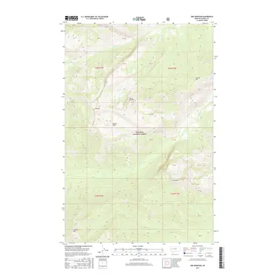
2017 Map of Una Mountain
USGS Topo · Published 2017About this map
Flathead National Forest encompasses this wilderness area in Powell County, dominated by a series of prominent peaks and high mountain basins. The landscape is defined by the significant elevation of Cardinal Peak in the southwest and Una Mtn toward the center, creating a complex drainage system. These heights feed numerous watercourses, including Gordon Cr, which flows through the central valley, and Bartlett Cr in the north.
Find a feature on this map
24 named features on this map. Tap any name to fly to it.
Don’t see what you’re looking for? This feature index may not catch every label — zoom into the map to look around manually.
Map Details
Editions of this 2017 Una Mountain Map
This is the sole edition of this map. No revisions or reprints were ever made.
Other maps of this area

1902 · Ovando
USGS Topo · 1:125,000

1905 · Ovando
USGS Topo · 1:125,000

1936 · Silvertip
USGS Topo · 1:96,000

1942 · Silvertip
USGS Topo · 1:125,000

1955 · Choteau
USGS Topo · 1:250,000

1957 · Choteau
USGS Topo · 1:250,000

1958 · Choteau
USGS Topo · 1:250,000

1962 · Choteau
USGS Topo · 1:250,000
1970 · Crimson Peak
USGS Topo · 1:24,000

1970 · Big Salmon Lake East
USGS Topo · 1:24,000