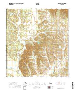
2017 Map of Unalakleet A-1 NW
USGS Topo · Published 2017About this map
Innoko National Wildlife Refuge dominates the central and northern sections of this Alaskan landscape, protecting a significant portion of the Yukon-Koyukuk interior. The terrain is characterized by complex contouring that defines the drainage basin of Sucker Cr, which winds through the southeastern quadrant of the survey. As an uninhabited wilderness area, the map provides a precise layout of the township and range system, specifically marking t26s r4w, t26s r3w, t27s r4w, and t27s r3w. These survey lines emphasize the administrative division of this roadless region within the Unalakleet A-1 NW quadrangle, where the natural hydrography and elevation data are the primary indicators of the land's character.
Find a feature on this map
6 named features on this map. Tap any name to fly to it.
Don’t see what you’re looking for? This feature index may not catch every label — zoom into the map to look around manually.
Map Details
Editions of this 2017 Unalakleet A-1 NW Map
This is the sole edition of this map. No revisions or reprints were ever made.
Other maps of this area

1951 · Unalakleet
USGS Topo · 1:250,000

1952 · Unalakleet A-2
USGS Topo · 1:63,360

1952 · Unalakleet A-1
USGS Topo · 1:63,360

1952 · Unalakleet B-2
USGS Topo · 1:63,360

1952 · Unalakleet B-1
USGS Topo · 1:63,360

1952 · Unalakleet
USGS Topo · 1:250,000

1964 · Unalakleet
USGS Topo · 1:250,000
2015 · Unalakleet B-2 SE
USGS Topo · 1:25,000
2015 · Unalakleet B-1 SW
USGS Topo · 1:25,000
2015 · Unalakleet B-1 SE
USGS Topo · 1:25,000