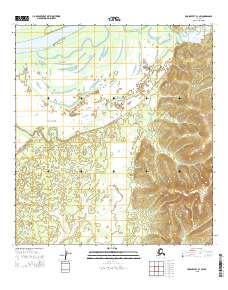
2015 Map of Unalakleet B-1 SW
USGS Topo · Published 2015About this map
The Yukon River and its intricate drainage systems define this section of the Alaskan interior near the Unalakleet region. A prominent feature of the low-lying fluvial landscape is the Yokontoh Slough, which meanders through the northwest, illustrating the shifting nature of northern waterways. This 2015 survey reveals a terrain transitioning from the broad, active river plains to more defined upland drainage patterns. Smaller tributaries such as Papa-Willie Creek and Saint Joe Creek feed into the larger system, while Muller Cr and Shovel Cr cut through the rising elevation to the east. The map provides a precise record of the Public Land Survey System grid, including boundaries for t24s r4w and t25s r3w, marking the intersection of topography and official land division in this largely uninhabited wilderness.
Find a feature on this map
13 named features on this map. Tap any name to fly to it.
Don’t see what you’re looking for? This feature index may not catch every label — zoom into the map to look around manually.
Map Details
Editions of this 2015 Unalakleet B-1 SW Map
This is the sole edition of this map. No revisions or reprints were ever made.
Other maps of this area

1951 · Unalakleet
USGS Topo · 1:250,000

1952 · Unalakleet A-2
USGS Topo · 1:63,360

1952 · Unalakleet A-1
USGS Topo · 1:63,360

1952 · Unalakleet B-2
USGS Topo · 1:63,360

1952 · Unalakleet B-1
USGS Topo · 1:63,360

1952 · Unalakleet
USGS Topo · 1:250,000

1964 · Unalakleet
USGS Topo · 1:250,000
2015 · Unalakleet B-2 SE
USGS Topo · 1:25,000
2015 · Unalakleet B-1 SE
USGS Topo · 1:25,000
2015 · Unalakleet B-1 NE
USGS Topo · 1:25,000