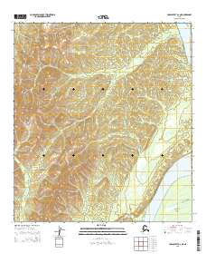
2015 Map of Unalakleet B-2 NE
USGS Topo · Published 2015About this map
Yukon River dominance defines the eastern reaches of this interior Alaska landscape, where the massive waterway transitions past the prominent Blackburn Island. The terrain is characterized by a dense network of drainage systems feeding toward the river, including the winding paths of Dugan Cr and Woods Cr. This 2015 survey illustrates the topographic complexity of the Yukon-Koyukuk region, showing how the land rises into significant elevations away from the riverbank. The western portions of the sheet are defined by the headwaters of Blackburn Cr, showcasing a wilderness largely untouched by permanent road infrastructure or industrial development. This map serves as a vital record of the natural hydrography and public land survey boundaries in a remote corridor of the state.
Find a feature on this map
11 named features on this map. Tap any name to fly to it.
Don’t see what you’re looking for? This feature index may not catch every label — zoom into the map to look around manually.
Map Details
Editions of this 2015 Unalakleet B-2 NE Map
This is the sole edition of this map. No revisions or reprints were ever made.
Other maps of this area

1951 · Unalakleet
USGS Topo · 1:250,000

1952 · Unalakleet C-2
USGS Topo · 1:63,360

1952 · Unalakleet C-1
USGS Topo · 1:63,360

1952 · Unalakleet B-2
USGS Topo · 1:63,360

1952 · Unalakleet B-1
USGS Topo · 1:63,360

1952 · Unalakleet
USGS Topo · 1:250,000

1964 · Unalakleet
USGS Topo · 1:250,000
2015 · Unalakleet B-2 SE
USGS Topo · 1:25,000
2015 · Unalakleet C-1 SW
USGS Topo · 1:25,000
2015 · Unalakleet C-2 SW
USGS Topo · 1:25,000