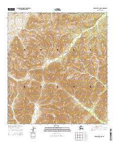
2015 Map of Unalakleet B-2 NW
USGS Topo · Published 2015About this map
Old Woman River defines the western landscape of this interior terrain, where high-elevation drainage patterns reveal a complex network of seasonal creeks. The terrain is characterized by the convergence of several named waterways, including McDonald Cr which feeds into the larger river system from the west. Centrally, Thompson Cr and Blackburn Cr illustrate the watershed of the Unalakleet region, providing a detailed record of the natural hydrology in the Unalakleet B-2 NW quadrangle. The surveying of the township lines t23s r7w and t24s r6w shows the formal organization of this undeveloped Alaskan wilderness, where the lack of road infrastructure or structures highlights the reliance on natural river corridors for navigation and boundary marking during this era.
Find a feature on this map
8 named features on this map. Tap any name to fly to it.
Don’t see what you’re looking for? This feature index may not catch every label — zoom into the map to look around manually.
Map Details
Editions of this 2015 Unalakleet B-2 NW Map
This is the sole edition of this map. No revisions or reprints were ever made.
Other maps of this area

1951 · Unalakleet
USGS Topo · 1:250,000

1952 · Unalakleet C-2
USGS Topo · 1:63,360

1952 · Unalakleet C-3
USGS Topo · 1:63,360

1952 · Unalakleet B-3
USGS Topo · 1:63,360

1952 · Unalakleet B-2
USGS Topo · 1:63,360

1952 · Unalakleet
USGS Topo · 1:250,000

1964 · Unalakleet
USGS Topo · 1:250,000
2015 · Unalakleet B-2 SE
USGS Topo · 1:25,000
2015 · Unalakleet B-3 NE
USGS Topo · 1:25,000
2015 · Unalakleet C-2 SW
USGS Topo · 1:25,000