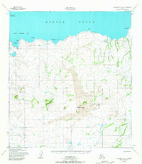
1952 Map of Unalakleet B-6
USGS Topo · Published 1967About this map
Norton Sound defines the northern edge of this coastal landscape, where the tides of Saint Michael Bay meet a complex shoreline of points and coves. The presence of Healy (Aban'd) suggests the shifting nature of early 20th-century outposts along these waters, while a lonely Cabin and the Whale Island Light near Whale Island mark the scattered human presence in a territory primarily shaped by volcanic geology.
Find a feature on this map
22 named features on this map. Tap any name to fly to it.
Don’t see what you’re looking for? This feature index may not catch every label — zoom into the map to look around manually.
Map Details
Editions of this 1952 Unalakleet B-6 Map
2 editions found
Other maps of this area

1951 · Unalakleet
USGS Topo · 1:250,000

1951 · St Michael
USGS Topo · 1:250,000
1952 · Saint Michael C-1
USGS Topo · 1:63,360

1952 · Saint Michael B-1
USGS Topo · 1:63,360

1952 · Saint Michael A-1
USGS Topo · 1:63,360

1952 · Unalakleet A-5
USGS Topo · 1:63,360

1952 · Unalakleet B-6
USGS Topo · 1:63,360

1952 · Unalakleet B-5
USGS Topo · 1:63,360
1952 · Unalakleet C-5
USGS Topo · 1:63,360

1952 · Unalakleet A-6
USGS Topo · 1:63,360