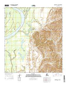
2015 Map of Unalakleet C-1 NE
USGS Topo · Published 2015About this map
Honeymoon Slough meanders through this remote stretch of the Alaskan interior, illustrating a complex network of waterways typical of the region's riverine floodplains. Surveyed by the U.S. Geological Survey, this 2015 study details the low-lying wetlands and intricate drainage patterns between Kinsell Slough and the eastern highlands. The topography transitions from saturated valley floors to significant elevations in the eastern portion of the quadrangle, where the terrain rises sharply from the marshy lowlands. This detailed record of the landscape highlights the seasonal nature of the terrain, where shifting water levels define the geography of the Unalakleet region.
Find a feature on this map
6 named features on this map. Tap any name to fly to it.
Don’t see what you’re looking for? This feature index may not catch every label — zoom into the map to look around manually.
Map Details
Editions of this 2015 Unalakleet C-1 NE Map
This is the sole edition of this map. No revisions or reprints were ever made.
Other maps of this area

1951 · Ophir
USGS Topo · 1:250,000

1951 · Unalakleet
USGS Topo · 1:250,000

1952 · Unalakleet C-1
USGS Topo · 1:63,360

1952 · Unalakleet D-1
USGS Topo · 1:63,360

1952 · Unalakleet
USGS Topo · 1:250,000
1954 · Ophir D-6
USGS Topo · 1:63,360

1954 · Ophir C-6
USGS Topo · 1:63,360

1954 · Ophir
USGS Topo · 1:250,000

1964 · Unalakleet
USGS Topo · 1:250,000
2015 · Unalakleet C-1 SE
USGS Topo · 1:25,000