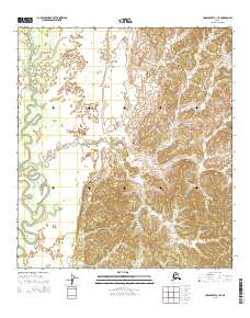
2015 Map of Unalakleet C-1 SE
USGS Topo · Published 2015About this map
Papa Willie Creek meanders through the western portion of this terrain, marking the low-lying drainage within the Kaiyuh Mountains range. The landscape is defined by its dramatic elevation changes, transitioning from the creek's riparian corridor to the ridgelines of the southeastern peaks. This 2015 survey reflects the Public Land Survey System grid across multiple townships, including t21s r3w, t22s r2w, and t23s r3w. The map preserves the original topographic detail of this interior Alaskan wilderness, highlighting the complex network of drainage basins and high-altitude relief that characterizes the Yukon-Koyukuk region.
Find a feature on this map
8 named features on this map. Tap any name to fly to it.
Don’t see what you’re looking for? This feature index may not catch every label — zoom into the map to look around manually.
Map Details
Editions of this 2015 Unalakleet C-1 SE Map
This is the sole edition of this map. No revisions or reprints were ever made.
Other maps of this area

1951 · Ophir
USGS Topo · 1:250,000

1951 · Unalakleet
USGS Topo · 1:250,000

1952 · Unalakleet C-1
USGS Topo · 1:63,360

1952 · Unalakleet B-1
USGS Topo · 1:63,360

1952 · Unalakleet
USGS Topo · 1:250,000

1954 · Ophir C-6
USGS Topo · 1:63,360
1954 · Ophir B-6
USGS Topo · 1:63,360

1954 · Ophir
USGS Topo · 1:250,000

1964 · Unalakleet
USGS Topo · 1:250,000
2015 · Unalakleet C-1 NE
USGS Topo · 1:25,000