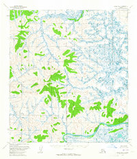
1954 Map of Ophir B-6
USGS Topo · Published 1965About this map
The Innoko River winds through the southern reaches of this interior Alaskan landscape, serving as a primary drainage for a vast network of wetlands and minor streams. Surveyed in the mid-1950s using photogrammetric methods from aerial photographs, the terrain is characterized by a high concentration of small ponds and unnamed marshes. Rising above the low-lying drainage area, Lone Mtn provides a significant topographic reference point. The Kateel River Meridian serves as the longitudinal baseline for the land lines shown here, which at the time of publication represented unsurveyed and unmarked locations predetermined by the Bureau of Land Management. The absence of roads, trails, or permanent settlements reflects the remote nature of the region during this period of geological study.
Find a feature on this map
7 named features on this map. Tap any name to fly to it.
Don’t see what you’re looking for? This feature index may not catch every label — zoom into the map to look around manually.
Map Details
Editions of this 1954 Ophir B-6 Map
This is the sole edition of this map. No revisions or reprints were ever made.
Other maps of this area

1951 · Ophir
USGS Topo · 1:250,000

1951 · Unalakleet
USGS Topo · 1:250,000

1952 · Unalakleet A-1
USGS Topo · 1:63,360

1952 · Unalakleet C-1
USGS Topo · 1:63,360

1952 · Unalakleet B-1
USGS Topo · 1:63,360

1952 · Unalakleet
USGS Topo · 1:250,000

1954 · Ophir A-6
USGS Topo · 1:63,360

1954 · Ophir A-5
USGS Topo · 1:63,360

1954 · Ophir C-6
USGS Topo · 1:63,360

1954 · Ophir C-5
USGS Topo · 1:63,360