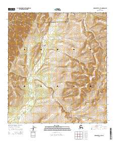
2015 Map of Unalakleet C-3 SE
USGS Topo · Published 2015About this map
The Anvik River meanders through this portion of the interior, crossing a significant administrative boundary between the Nome Census Area and the Yukon-Koyukuk Census Area. This 2015 U.S. Geological Survey representation emphasizes the natural topography of the river corridor, which remains the primary geographic feature in an area otherwise defined by its vast elevation contours and township divisions. The lack of named settlements or infrastructure highlights the remote character of this region, where the Anvik River serves as the central landmark for navigation and location. Researchers interested in the border between these two census areas can trace the exact line as it intersects the river's path, providing a modern record of official boundaries in the Alaskan wilderness.
Find a feature on this map
8 named features on this map. Tap any name to fly to it.
Don’t see what you’re looking for? This feature index may not catch every label — zoom into the map to look around manually.
Map Details
Editions of this 2015 Unalakleet C-3 SE Map
This is the sole edition of this map. No revisions or reprints were ever made.
Other maps of this area

1951 · Unalakleet
USGS Topo · 1:250,000

1952 · Unalakleet C-2
USGS Topo · 1:63,360

1952 · Unalakleet C-3
USGS Topo · 1:63,360

1952 · Unalakleet B-3
USGS Topo · 1:63,360

1952 · Unalakleet B-2
USGS Topo · 1:63,360

1952 · Unalakleet
USGS Topo · 1:250,000

1964 · Unalakleet
USGS Topo · 1:250,000
2015 · Unalakleet C-2 NW
USGS Topo · 1:25,000
2015 · Unalakleet B-3 NE
USGS Topo · 1:25,000
2015 · Unalakleet B-3 NW
USGS Topo · 1:25,000