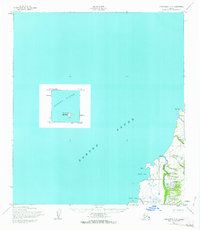
1952 Map of Unalakleet C-5
USGS Topo · Published 1963About this map
Norton Sound dominates this mid-century topographic survey of the Alaska coastline, revealing a remote landscape where travel was dictated by the seasons. The settlement of Golsovia sits near the mouth of the Golsovia River, serving as a vital waypoint along a Winter Trail that traced the rugged shoreline. This network of trails and coastal markers reflects the traditional transit routes used before modern infrastructure reached this part of the Nome region.
Find a feature on this map
13 named features on this map. Tap any name to fly to it.
Don’t see what you’re looking for? This feature index may not catch every label — zoom into the map to look around manually.
Map Details
Editions of this 1952 Unalakleet C-5 Map
3 editions found
Other maps of this area

1950 · Unalakleet D-4
USGS Topo · 1:63,360

1951 · Unalakleet
USGS Topo · 1:250,000

1952 · Unalakleet B-4
USGS Topo · 1:63,360

1952 · Unalakleet B-6
USGS Topo · 1:63,360

1952 · Unalakleet C-4
USGS Topo · 1:63,360

1952 · Unalakleet B-5
USGS Topo · 1:63,360
1952 · Unalakleet C-5
USGS Topo · 1:63,360

1952 · Unalakleet
USGS Topo · 1:250,000

1964 · Unalakleet
USGS Topo · 1:250,000
2016 · Unalakleet C-4 SW
USGS Topo · 1:25,000