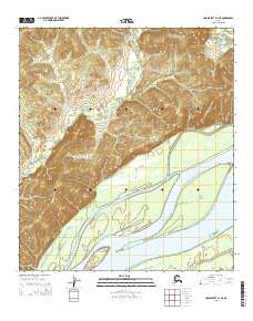
2015 Map of Unalakleet D-1 NE
USGS Topo · Published 2015About this map
The Yukon River dominates this landscape, carving a wide path through the subarctic terrain of the Unalakleet D-1 NE quadrangle. The river’s shifting nature is evident in the complex network of side channels and islands, most notably the large Quail Island and the meandering Leah Slough. These waterways suggest a seasonal pulse where water levels dictate access and land use in this remote portion of the Alaskan interior.
Find a feature on this map
13 named features on this map. Tap any name to fly to it.
Don’t see what you’re looking for? This feature index may not catch every label — zoom into the map to look around manually.
Map Details
Editions of this 2015 Unalakleet D-1 NE Map
This is the sole edition of this map. No revisions or reprints were ever made.
Other maps of this area

1945 · Nulato
USGS Topo · 1:250,000

1948 · Norton Bay
USGS Topo · 1:250,000

1951 · Ophir
USGS Topo · 1:250,000

1951 · Nulato
USGS Topo · 1:250,000

1951 · Unalakleet
USGS Topo · 1:250,000

1951 · Norton Bay
USGS Topo · 1:250,000

1952 · Nulato
USGS Topo · 1:250,000

1952 · Nulato A-6
USGS Topo · 1:63,360

1952 · Unalakleet D-1
USGS Topo · 1:63,360

1952 · Unalakleet
USGS Topo · 1:250,000