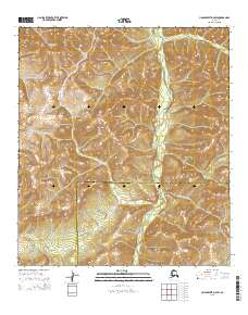
2015 Map of Unalakleet D-2 SW
USGS Topo · Published 2015About this map
The Old Woman River winds through the southwestern reaches of the Nulato Hills, defining a landscape of high ridges and deep river valleys in this interior section of the Unalakleet region. This 2015 survey precisely documents the administrative divide between the Nome Census Area and the Yukon-Koyukuk Census Area, a boundary that follows the high terrain south of Stove Cr. The map reveals the intricate drainage patterns of the Alaskan wilderness before it meets the coast, showcasing the untouched nature of the terrain where elevation and water define all movement. It is a vital record for understanding the modern jurisdictional lines and geographic isolation of the eastern Seward Peninsula hinterlands.
Find a feature on this map
8 named features on this map. Tap any name to fly to it.
Don’t see what you’re looking for? This feature index may not catch every label — zoom into the map to look around manually.
Map Details
Editions of this 2015 Unalakleet D-2 SW Map
This is the sole edition of this map. No revisions or reprints were ever made.
Other maps of this area

1950 · Unalakleet D-3
USGS Topo · 1:63,360

1951 · Unalakleet
USGS Topo · 1:250,000

1952 · Unalakleet C-2
USGS Topo · 1:63,360

1952 · Unalakleet D-2
USGS Topo · 1:63,360

1952 · Unalakleet C-3
USGS Topo · 1:63,360

1952 · Unalakleet
USGS Topo · 1:250,000

1964 · Unalakleet
USGS Topo · 1:250,000
2015 · Unalakleet C-2 NE
USGS Topo · 1:25,000
2015 · Unalakleet C-2 NW
USGS Topo · 1:25,000
2015 · Unalakleet D-3 SE
USGS Topo · 1:25,000