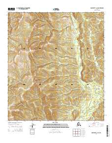
2015 Map of Unalakleet C-2 NE
USGS Topo · Published 2015About this map
Nulato Hills dominate this portion of the Alaskan interior, showing a landscape defined by sharp elevation changes and high-altitude drainage systems. The survey detail illuminates the headwaters of Bear Cr and Jenson Cr, which carve narrow paths through the upland terrain. This specific USGS quadrangle reveals the complex topographic patterns of the region, emphasizing the drainage basins that feed into larger interior river systems. The inclusion of the Public Land Survey System grid lines provides a structured overlay for the otherwise untamed terrain of the Nulato Hills.
Find a feature on this map
9 named features on this map. Tap any name to fly to it.
Don’t see what you’re looking for? This feature index may not catch every label — zoom into the map to look around manually.
Map Details
Editions of this 2015 Unalakleet C-2 NE Map
This is the sole edition of this map. No revisions or reprints were ever made.
Other maps of this area

1951 · Unalakleet
USGS Topo · 1:250,000

1952 · Unalakleet C-2
USGS Topo · 1:63,360

1952 · Unalakleet D-2
USGS Topo · 1:63,360

1952 · Unalakleet C-1
USGS Topo · 1:63,360

1952 · Unalakleet D-1
USGS Topo · 1:63,360

1952 · Unalakleet
USGS Topo · 1:250,000

1964 · Unalakleet
USGS Topo · 1:250,000
2015 · Unalakleet D-2 SW
USGS Topo · 1:25,000
2015 · Unalakleet C-1 SW
USGS Topo · 1:25,000
2015 · Unalakleet C-2 NW
USGS Topo · 1:25,000