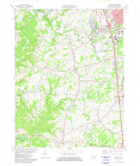
1982 Map of Union
USGS Topo · Published 1982About this map
Big Bone Lick State Park occupies the southwestern corner of this landscape, where the waters of Big Bone Creek and Beaver Branch meet. This 1982 revision documents a transitional era in northern Kentucky, showing the intensifying suburban development of Florence and the Southern railroad corridor alongside long-established rural hamlets. The map captures the uniquely named settlement of Sugartit near the South Fork Gunpowder Creek, a place-name reflecting the area's vernacular history.
Find a feature on this map
42 named features on this map. Tap any name to fly to it.
Don’t see what you’re looking for? This feature index may not catch every label — zoom into the map to look around manually.
Map Details
Editions of this 1982 Union Map
2 editions found
Other maps of this area

1914 · West Cincinnati
USGS Topo · 1:62,500

1915 · Lawrenceburg
USGS Topo · 1:48,000

1928 · Lawrenceburg
USGS Topo · 1:62,500

1932 · Lawrenceburg
USGS Topo · 1:62,500

1943 · Rising Sun
USGS Topo · 1:24,000

1943 · Lawrenceburg
USGS Topo · 1:24,000

1943 · Patriot
USGS Topo · 1:24,000

1950 · Union
USGS Topo · 1:24,000

1950 · Independence
USGS Topo · 1:24,000

1950 · Verona
USGS Topo · 1:24,000