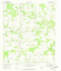
1969 Map of Union Center
USGS Topo · Published 1972About this map
The Sabana River winds through the central Eastland County landscape, shaping a terrain defined by small farming communities and emerging petroleum interests in the late 1960s. Scattered settlements like Romney, Union Center, and Okra anchor the rural road network, while the presence of several Oil Wells across the quadrangle indicates the industrial footprint of the era. The land is drained by a network of waterways including Elm Creek, Yellow Branch, and Long Branch, the latter of which lends its name to the local Long Branch Ch.
Find a feature on this map
15 named features on this map. Tap any name to fly to it.
Don’t see what you’re looking for? This feature index may not catch every label — zoom into the map to look around manually.
Map Details
Editions of this 1969 Union Center Map
2 editions found
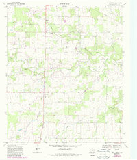
Other maps of this area

1894 · Eastland
USGS Topo · 1:125,000

1931 · Baird
USGS Topo · 1:125,000

1932 · Baird
USGS Topo · 1:125,000

1954 · Abilene
USGS Topo · 1:250,000

1958 · Abilene
USGS Topo · 1:250,000

1966 · Sipe Springs
USGS Topo · 1:24,000
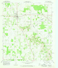
1966 · Rising Star
USGS Topo · 1:24,000

1966 · Carbon
USGS Topo · 1:24,000

1966 · Scranton
USGS Topo · 1:24,000

1966 · Cisco South
USGS Topo · 1:24,000