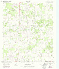
1969 Map of Union Center
USGS Topo · Published 1987About this map
Union Center and Romney anchor this late 1960s rural landscape in Eastland County, where the topography is defined by the winding course of the Sabana River and its numerous tributaries. The map reveals a dispersed settlement pattern typical of the Texas Cross Timbers region, characterized by small crossroads communities and family landmarks. Cultural sites such as Long Branch Ch and Elm Cem provide valuable focal points for genealogical research, while the presence of several Gravel Pits and scattered gas wells indicates a landscape of both agricultural and extractive use. The 1987 photorevisions, shown in purple, capture shifts in land use and road infrastructure since the original 1969 field check, particularly along the waterways of Long Branch and Yellow Branch.
Find a feature on this map
11 named features on this map. Tap any name to fly to it.
Don’t see what you’re looking for? This feature index may not catch every label — zoom into the map to look around manually.
Map Details
Editions of this 1969 Union Center Map
2 editions found
Other maps of this area

1894 · Eastland
USGS Topo · 1:125,000

1931 · Baird
USGS Topo · 1:125,000

1932 · Baird
USGS Topo · 1:125,000

1954 · Abilene
USGS Topo · 1:250,000

1958 · Abilene
USGS Topo · 1:250,000

1966 · Sipe Springs
USGS Topo · 1:24,000
1966 · Rising Star
USGS Topo · 1:24,000

1966 · Carbon
USGS Topo · 1:24,000

1966 · Scranton
USGS Topo · 1:24,000

1966 · Cisco South
USGS Topo · 1:24,000