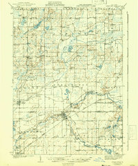
1918 Map of Union City
USGS Topo · Published 1942About this map
Union City and the crossing of the ST Joseph River anchor this landscape during a period of established agricultural and rail commerce. The Michigan Central Railroad follows the winding river corridor, connecting regional hubs like Sherwood and Burlington, where the Burlington Sta served as a vital transit point. This survey reveals a dense network of early 20th-century rural infrastructure, characterized by an exceptionally high concentration of family and community schoolhouses, such as Sonoma Sch, Abscota Sch, and Tadmore Sch.
Find a feature on this map
101 named features on this map. Tap any name to fly to it.
Don’t see what you’re looking for? This feature index may not catch every label — zoom into the map to look around manually.
Map Details
Editions of this 1918 Union City Map
3 editions found
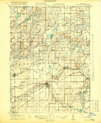
Other maps of this area

1918 · Battle Creek
USGS Topo · 1:62,500

1918 · Union City
USGS Topo · 1:62,500

1918 · Galesburg
USGS Topo · 1:62,500

1918 · Leonidas
USGS Topo · 1:62,500

1921 · Marshall
USGS Topo · 1:62,500

1923 · Marshall
USGS Topo · 1:62,500

1943 · Battle Creek
USGS Topo · 1:62,500

1943 · Marshall
USGS Topo · 1:62,500

1944 · Leonidas
USGS Topo · 1:62,500

1944 · Galesburg
USGS Topo · 1:62,500