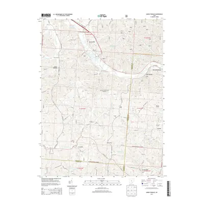
2013 Map of Union Furnace
USGS Topo · Published 2013About this map
The Hocking River winds through this landscape on the border of Hocking and Athens counties, passing the industrial and mining heritage sites of Nelsonville and Haydenville. This region is defined by its deep ridges and hollows, much of which is managed as part of the Wayne National Forest. Settlement patterns follow the narrow valley floors, where clusters of local history like Union Furnace and East Clayton sit along established routes such as US Hwy 33 and State Rte 328. Genealogists will find a wealth of scattered burial sites throughout the uplands, including Croy Cem, Wolf Cem, and the Morse Lewis Cem. To the south, the terrain descends toward Carbondale and the headwaters of Carbondale Cr, illustrating the interconnectedness of the river-and-rail economy that once dominated these southeastern Ohio hills.
Find a feature on this map
71 named features on this map. Tap any name to fly to it.
Don’t see what you’re looking for? This feature index may not catch every label — zoom into the map to look around manually.
Map Details
Editions of this 2013 Union Furnace Map
This is the sole edition of this map. No revisions or reprints were ever made.
Other maps of this area

1903 · Athens
USGS Topo · 1:62,500

1904 · Zaleski
USGS Topo · 1:62,500

1905 · Athens
USGS Topo · 1:62,500

1907 · Zaleski
USGS Topo · 1:62,500

1907 · Logan
USGS Topo · 1:62,500

1909 · Logan
USGS Topo · 1:62,500

1911 · New Lexington
USGS Topo · 1:62,500

1947 · Columbus
USGS Topo · 1:250,000

1961 · Columbus
USGS Topo · 1:250,000

1961 · Nelsonville
USGS Topo · 1:24,000