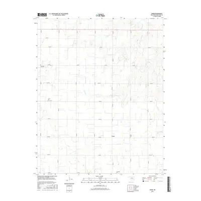
2016 Map of Union
USGS Topo · Published 2016About this map
Union serves as the central focal point of this Kingfisher County landscape, where the prairie is etched by a network of drainage systems including Spring Cr, Camp Cr, and Cottonwood Cr. The settlement pattern is defined by a rigid section-line road grid, with routes such as Banner Rd and various numerical county roads facilitating travel through the agricultural terrain. For genealogists and local historians, the map is particularly valuable for its documentation of several distinct burial sites dispersed across the territory. These include Saint Joseph's Catholic Cem in the northwest, Oakview Cem, Oak Grove Cem near the central hub, and Wanamaker Cem to the south. The distribution of these cemeteries suggests the locations of earlier community congregations and family clusters within the rural landscape.
Find a feature on this map
25 named features on this map. Tap any name to fly to it.
Don’t see what you’re looking for? This feature index may not catch every label — zoom into the map to look around manually.
Map Details
Editions of this 2016 Union Map
This is the sole edition of this map. No revisions or reprints were ever made.
Other maps of this area

1892 · Kingfisher
USGS Topo · 1:125,000

1893 · Lovell
USGS Topo · 1:62,500

1893 · Hennessey
USGS Topo · 1:62,500

1895 · Kingfisher
USGS Topo · 1:125,000

1954 · Oklahoma City
USGS Topo · 1:250,000

1955 · Enid
USGS Topo · 1:250,000

1956 · Hennessey
USGS Topo · 1:62,500

1957 · Oklahoma City
USGS Topo · 1:250,000

1958 · Enid
USGS Topo · 1:250,000

1963 · Oklahoma City
USGS Topo · 1:250,000