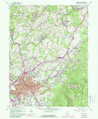
1963 Map of Uniontown
USGS Topo · Published 1988About this map
Uniontown serves as the focal point of this Fayette County survey, shown as a bustling hub of industry and transit at the base of Laurel Hill. The city is defined by a dense network of neighborhoods including South Uniontown, Leith, and Evans Manor, all connected by the historic National Pike. The landscape is etched with the legacy of the regional coal and iron economy, evidenced by numerous Strip Mines, Quarries, and industrial sites like Lemont Furnace.
Find a feature on this map
106 named features on this map. Tap any name to fly to it.
Don’t see what you’re looking for? This feature index may not catch every label — zoom into the map to look around manually.
Map Details
Editions of this 1963 Uniontown Map
Other maps of this area

1900 · Uniontown
USGS Topo · 1:62,500

1900 · Masontown
USGS Topo · 1:62,500

1902 · Brownsville
USGS Topo · 1:62,500

1902 · Connellsville
USGS Topo · 1:62,500

1903 · Masontown
USGS Topo · 1:62,500

1906 · Brownsville
USGS Topo · 1:62,500

1931 · Brownsville
USGS Topo · 1:62,500

1931 · Connellsville
USGS Topo · 1:62,500

1931 · Uniontown
USGS Topo · 1:62,500

1931 · Masontown
USGS Topo · 1:62,500
Featured Places
- Uniontown, PA
- Menallen Township, PA
- Franklin Township, PA
- South Union Township, PA
- North Union Township, PA