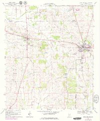
1968 Map of Uniontown West
USGS Topo · Published 1979About this map
The Southern railroad corridor connects the agricultural landscapes of Marengo, Hale, and Perry counties, anchoring the regional centers of Uniontown and Faunsdale. In this late 1960s landscape, later updated in the 1970s, the rural community structure is visible through institutions like Hatch High Sch and Faunsdale Jr High Sch, alongside numerous country churches including Zion Hill Ch and the Rock Chapel. The presence of several Flowing Well labels in the northwest suggests the importance of artesian water for the local cattle and farming economy.
Find a feature on this map
37 named features on this map. Tap any name to fly to it.
Don’t see what you’re looking for? This feature index may not catch every label — zoom into the map to look around manually.
Map Details
Editions of this 1968 Uniontown West Map
3 editions found
Other maps of this area

1953 · Montgomery
USGS Topo · 1:250,000

1956 · Montgomery
USGS Topo · 1:250,000

1957 · Montgomery
USGS Topo · 1:250,000

1968 · Thomaston East
USGS Topo · 1:24,000

1968 · Uniontown West
USGS Topo · 1:24,000

1968 · Uniontown East
USGS Topo · 1:24,000

1968 · Thomaston West
USGS Topo · 1:24,000

1968 · Gallion
USGS Topo · 1:24,000

1968 · Central Mills
USGS Topo · 1:24,000

1979 · Scott Station
USGS Topo · 1:24,000