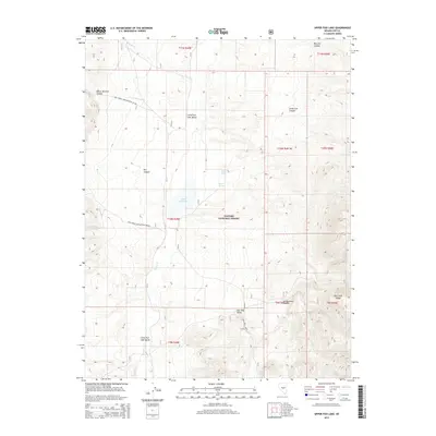
2014 Map of Upper Fish Lake
USGS Topo · Published 2014About this map
Upper Fish Lake sits at the heart of this high-desert basin, where the waters of Clover Cr and Green Monster Cr collect in the Little Fish Lake Valley. This 2014 survey by the U.S. Geological Survey documents a remote section of the Toiyabe National Forest, defined by the dramatic rise of the Hot Creek Range to the east. The map detail reveals an environment shaped by seasonal hydrology and geothermal activity, evidenced by Warm Spring and Upper Warm Spring along the valley's edge. Access to this isolated landscape is restricted to a few unpaved routes, including Natl Forest Develop Road 447 Rd and Natl Forest Develop Road 098 Rd. Narrow drainages like Green Monster Canyon and Cottonwood Canyon cut through the surrounding heights, leading down toward the southern Pott Hole Valley.
Find a feature on this map
27 named features on this map. Tap any name to fly to it.
Don’t see what you’re looking for? This feature index may not catch every label — zoom into the map to look around manually.
Map Details
Editions of this 2014 Upper Fish Lake Map
This is the sole edition of this map. No revisions or reprints were ever made.
Other maps of this area

1956 · Tonopah
USGS Topo · 1:250,000

1959 · Tonopah
USGS Topo · 1:250,000

1962 · Tonopah
USGS Topo · 1:250,000
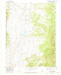
1967 · Upper Fish Lake
USGS Topo · 1:24,000
1967 · Morey Peak
USGS Topo · 1:24,000
1968 · Morey Peak
USGS Topo · 1:62,500
1968 · Fish Springs
USGS Topo · 1:62,500
1968 · Fish Springs SE
USGS Topo · 1:24,000
1968 · Fish Springs
USGS Topo · 1:24,000
1968 · Hobble Canyon
USGS Topo · 1:24,000