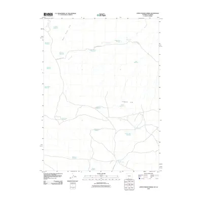
2010 Map of Upper Powder Spring
USGS Topo · Published 2010About this map
Upper Powder Spring and Lower Powder Spring anchor this arid landscape along the border of Wyoming and Colorado, where water management is the primary driver of development. The high desert terrain is defined by the prominent Skull Rim and Powder Rim, which create natural boundaries across the quadrangle. A sophisticated network of livestock infrastructure is evident through the naming of numerous reservoirs, including the aptly named Miserable Reservoir, Pronghorn Reservoir, and Hawk Nest Reservoir. These small catchments, linked by the Shell Creek Stock Trl, tell the story of a ranching economy adapted to the scarce moisture of the basins. Modern transit is limited to unpaved routes like County Rd 67, highlighting the region's continued status as a working landscape dedicated to range management and resource extraction.
Find a feature on this map
23 named features on this map. Tap any name to fly to it.
Don’t see what you’re looking for? This feature index may not catch every label — zoom into the map to look around manually.
Map Details
Editions of this 2010 Upper Powder Spring Map
This is the sole edition of this map. No revisions or reprints were ever made.
Other maps of this area

1954 · Vernal
USGS Topo · 1:250,000

1954 · Rock Springs
USGS Topo · 1:250,000

1958 · Vernal
USGS Topo · 1:250,000

1958 · Rock Springs
USGS Topo · 1:250,000

1960 · Vernal
USGS Topo · 1:250,000

1962 · Rock Springs
USGS Topo · 1:250,000

1969 · Reservoir Draw
USGS Topo · 1:24,000

1969 · Coffeepot Spring
USGS Topo · 1:24,000

1969 · Powder Wash
USGS Topo · 1:24,000

1970 · Cow Creek Reservoir
USGS Topo · 1:24,000