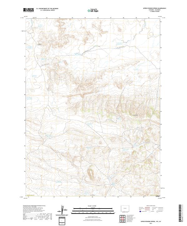
2021 Map of Upper Powder Spring
USGS Topo · Published 2021About this map
Upper Powder Spring and Lower Powder Spring anchor this high-desert landscape in southwestern Wyoming, where the water management of the rangeland is a central theme. The terrain is defined by the sharp elevations of Skull Creek Rim and Powder Rim, which dictate the flow of seasonal drainages like N Fork Powder Wash. This 2021 survey illustrates a sophisticated network of catchments and reservoirs essential for livestock, including Adobe Draw Reservoir and Agropyron Reservoir. The historical movement of cattle is preserved in the path of the Shell Creek Stock Trl, which winds through the northern sections of the map. While the names Miserable Reservoir and Washout Reservoir hint at the challenging conditions of the local environment, the abundance of named sites like Hawk Nest Reservoir and Long Ridge Reservoir reflects a deeply surveyed and managed territory within Sweetwater County.
Find a feature on this map
28 named features on this map. Tap any name to fly to it.
Don’t see what you’re looking for? This feature index may not catch every label — zoom into the map to look around manually.
Map Details
Editions of this 2021 Upper Powder Spring Map
This is the sole edition of this map. No revisions or reprints were ever made.
Other maps of this area

1954 · Vernal
USGS Topo · 1:250,000

1954 · Rock Springs
USGS Topo · 1:250,000

1958 · Vernal
USGS Topo · 1:250,000

1958 · Rock Springs
USGS Topo · 1:250,000

1960 · Vernal
USGS Topo · 1:250,000

1962 · Rock Springs
USGS Topo · 1:250,000

1969 · Reservoir Draw
USGS Topo · 1:24,000

1969 · Coffeepot Spring
USGS Topo · 1:24,000

1969 · Powder Wash
USGS Topo · 1:24,000

1970 · Cow Creek Reservoir
USGS Topo · 1:24,000