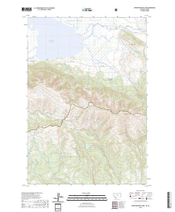
2024 Map of Upper Red Rock Lake
USGS Topo · Published 2024About this map
Upper Red Rock Lake dominates the northern expanse of this high-elevation landscape, where the waters of the Centennial Valley are protected within the Red Rock Lakes National Wildlife Refuge. The map details the transition from these expansive wetlands and water bodies like Shambow Pond to the steep rises of the Eastern Centennial Mountains. Significant summits including Sheep Mtn, Arrowhead Mountain, and Taylor Mtn define the southern horizon.
Find a feature on this map
37 named features on this map. Tap any name to fly to it.
Don’t see what you’re looking for? This feature index may not catch every label — zoom into the map to look around manually.
Map Details
Editions of this 2024 Upper Red Rock Lake Map
This is the sole edition of this map. No revisions or reprints were ever made.
Other maps of this area

1950 · Lower Red Rock Lake
USGS Topo · 1:62,500

1950 · Upper Red Rock Lake
USGS Topo · 1:62,500

1955 · Ashton
USGS Topo · 1:250,000

1958 · Ashton
USGS Topo · 1:250,000

1960 · Ashton
USGS Topo · 1:250,000
1965 · Icehouse Creek
USGS Topo · 1:24,000

1965 · Sheridan Reservoir
USGS Topo · 1:24,000

1972 · Antelope Valley
USGS Topo · 1:24,000
1988 · Hidden Lake Bench
USGS Topo · 1:24,000
1988 · Lower Red Rock Lake
USGS Topo · 1:24,000