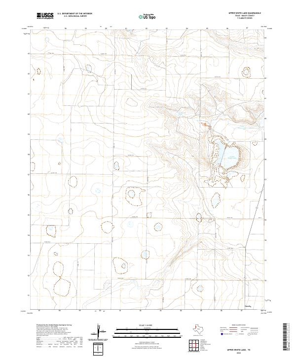
2022 Map of Upper White Lake
USGS Topo · Published 2022About this map
Enochs stands as the primary settlement in this corner of the High Plains, situated at the intersection of FM 37 and the local grid of Bailey County roads. The landscape is defined by a series of significant ephemeral water bodies that track through the center of the sheet, including Jack Young Lake, Upper Goose Lake, and the expansive Lower White Lake. These features suggest a natural drainage system that contrasts with the geometric precision of the surrounding agricultural sections. The map reveals a highly structured rural environment, where an extensive network of county roads, such as Co RD 1233 and Co RD 1292, divides the land into a consistent pattern of squares, reflecting the systematic settlement and land-use practices typical of this region of Texas.
Find a feature on this map
23 named features on this map. Tap any name to fly to it.
Don’t see what you’re looking for? This feature index may not catch every label — zoom into the map to look around manually.
Map Details
Editions of this 2022 Upper White Lake Map
This is the sole edition of this map. No revisions or reprints were ever made.
Other maps of this area

1954 · Clovis
USGS Topo · 1:250,000

1954 · Brownfield
USGS Topo · 1:250,000

1958 · Brownfield
USGS Topo · 1:250,000

1958 · Clovis
USGS Topo · 1:250,000

1962 · Brownfield
USGS Topo · 1:250,000

1962 · Needmore
USGS Topo · 1:24,000

1962 · Stegall
USGS Topo · 1:24,000

1962 · Baileyboro
USGS Topo · 1:24,000
1968 · Bula
USGS Topo · 1:24,000

1968 · Three Way School
USGS Topo · 1:24,000