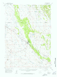
1957 Map of Upton
USGS Topo · Published 1959About this map
Upton serves as the central hub of this Wyoming landscape, where the Chicago Burlington and Quincy railroad tracks cut a definitive path through the terrain. The local economy is visibly shaped by natural resource extraction, evidenced by the numerous Clay Pits and a Gravel Pit scattered across the quadrangle, particularly along the prominent spine of Pine Ridge. This 1957 survey captures the town's social and recreational layout, featuring a Golf Course, Racetrack, Drive-in Theater, and an Airstrip situated near the town site.
Find a feature on this map
67 named features on this map. Tap any name to fly to it.
Don’t see what you’re looking for? This feature index may not catch every label — zoom into the map to look around manually.
Map Details
Editions of this 1957 Upton Map
2 editions found

Other maps of this area

1898 · Sundance
USGS Topo · 1:125,000

1899 · Newcastle
USGS Topo · 1:125,000

1901 · Newcastle
USGS Topo · 1:125,000

1902 · Sundance
USGS Topo · 1:125,000

1918 · Moorcroft
USGS Topo · 1:125,000

1918 · Moorcroft
USGS Topo · 1:62,500

1954 · Gillette
USGS Topo · 1:250,000

1955 · Newcastle
USGS Topo · 1:250,000

1955 · Gillette
USGS Topo · 1:250,000

1957 · Nefsy Divide
USGS Topo · 1:62,500