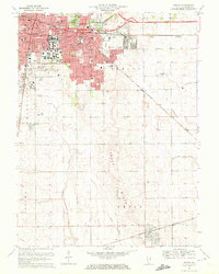
1970 Map of Urbana
USGS Topo · Published 1972About this map
The University of Illinois campus serves as the centerpiece of this 1970 landscape, where the sprawling academic grounds and landmarks like Memorial Stadium and the Assembly Hall meet the urban grids of Champaign City and Urbana. Beyond the city limits, the terrain shifts into the rolling glacial topography of Yankee Ridge and Philo Ridge, creating a distinctive upland character that separates the drainage of the Saline Branch from the headwaters of the Embarras River.
Find a feature on this map
80 named features on this map. Tap any name to fly to it.
Don’t see what you’re looking for? This feature index may not catch every label — zoom into the map to look around manually.
Map Details
Editions of this 1970 Urbana Map
3 editions found
Other maps of this area

1906 · Urbana
USGS Topo · 1:62,500

1907 · Mahomet
USGS Topo · 1:62,500

1950 · Tuscola
USGS Topo · 1:62,500

1956 · Villa Grove
USGS Topo · 1:62,500

1957 · Urbana
USGS Topo · 1:62,500

1957 · Urbana
USGS Topo · 1:24,000

1957 · Rising
USGS Topo · 1:24,000

1957 · Mahomet
USGS Topo · 1:62,500

1957 · Bondville
USGS Topo · 1:24,000
1957 · Thomasboro
USGS Topo · 1:24,000