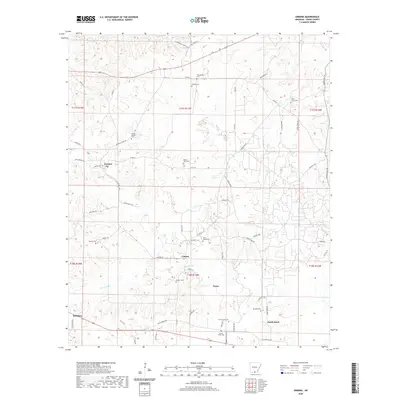
2020 Map of Urbana
USGS Topo · Published 2020About this map
Urbana and its surrounding rural communities in Union County appear here in a landscape defined by small settlements and a high density of local burial grounds. The settlement pattern is scattered, with nodes like Lawson and Payne connected by a network of winding roads such as Lawson Rd and Old Strong Hwy. This concentration of namesake cemeteries, including the Philadelphia Cem, Cathey Cem, and Knowles Cem, suggests a deeply rooted residential history and multiple generations of land ownership. The terrain is dissected by several small waterways, most notably Cypress Cr, Dry Cr, and Woodard Cr, which likely influenced the early placement of homesteads. In the southwest corner, the community of Hillsboro sits near the intersection of several local routes, while the eastern edge is anchored by Sandy Bend, illustrating the quiet, persistent rural character of southern Arkansas.
Find a feature on this map
66 named features on this map. Tap any name to fly to it.
Don’t see what you’re looking for? This feature index may not catch every label — zoom into the map to look around manually.
Map Details
Editions of this 2020 Urbana Map
This is the sole edition of this map. No revisions or reprints were ever made.
Other maps of this area

1927 · El Dorado
USGS Topo · 1:62,500

1930 · El Dorado
USGS Topo · 1:62,500

1933 · Strong
USGS Topo · 1:62,500

1934 · Moro Bay
USGS Topo · 1:62,500

1937 · Strong
USGS Topo · 1:62,500

1938 · Moro Bay
USGS Topo · 1:62,500

1939 · Moro Bay
USGS Topo · 1:62,500

1939 · Strong
USGS Topo · 1:62,500

1951 · El Dorado
USGS Topo · 1:62,500

1953 · El Dorado
USGS Topo · 1:250,000