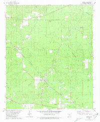
1981 Map of Urbana
USGS Topo · Published 1981About this map
Urbana and its surrounding countryside reflect a landscape deeply intertwined with the early 1980s petroleum and timber economies of Union County. Extensive Oil Field designations and numerous Oil Wells dot the terrain, particularly around Lawson and north of the Missouri Pacific railroad line. The settlement pattern is anchored by a high density of rural religious and community markers, including Philadelphia Ch, Rhodes Chapel, and the Church of God in Christ. These small landmarks, alongside cemeteries such as Center Point Cem, provide a clear view of the area's social geography.
Find a feature on this map
34 named features on this map. Tap any name to fly to it.
Don’t see what you’re looking for? This feature index may not catch every label — zoom into the map to look around manually.
Map Details
Editions of this 1981 Urbana Map
This is the sole edition of this map. No revisions or reprints were ever made.
Other maps of this area

1927 · El Dorado
USGS Topo · 1:62,500

1930 · El Dorado
USGS Topo · 1:62,500

1933 · Strong
USGS Topo · 1:62,500

1934 · Moro Bay
USGS Topo · 1:62,500

1937 · Strong
USGS Topo · 1:62,500

1938 · Moro Bay
USGS Topo · 1:62,500

1939 · Moro Bay
USGS Topo · 1:62,500

1939 · Strong
USGS Topo · 1:62,500

1951 · El Dorado
USGS Topo · 1:62,500

1953 · El Dorado
USGS Topo · 1:250,000