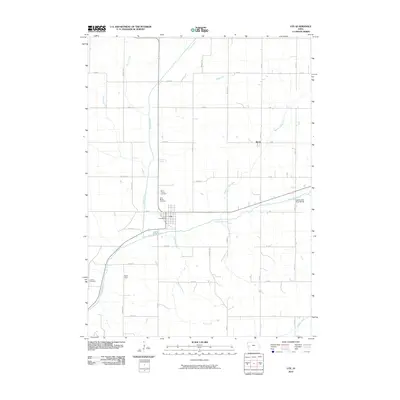
2010 Map of Ute
USGS Topo · Published 2010About this map
Ute serves as the primary hub of this western Iowa landscape, where the Soldier River and its various branches create a distinct drainage pattern across Monona County. The town is anchored by the Ute Post Office and bordered by significant local sites including Saint Clairce Cemetery and Saint Marys Cemetery to the north. The survey details the convergence of the Middle Soldier River and East Soldier River, the latter of which is spanned by the East Soldier River Bridge east of town.
Find a feature on this map
41 named features on this map. Tap any name to fly to it.
Don’t see what you’re looking for? This feature index may not catch every label — zoom into the map to look around manually.
Map Details
Editions of this 2010 Ute Map
This is the sole edition of this map. No revisions or reprints were ever made.
Other maps of this area

1954 · Omaha
USGS Topo · 1:250,000

1954 · Fort Dodge
USGS Topo · 1:250,000

1957 · Omaha
USGS Topo · 1:250,000

1957 · Fort Dodge
USGS Topo · 1:250,000

1958 · Omaha
USGS Topo · 1:250,000

1958 · Fort Dodge
USGS Topo · 1:250,000

1969 · Danbury
USGS Topo · 1:24,000

1969 · Mapleton
USGS Topo · 1:24,000
1971 · Mapleton SE
USGS Topo · 1:24,000

1971 · Ricketts
USGS Topo · 1:24,000