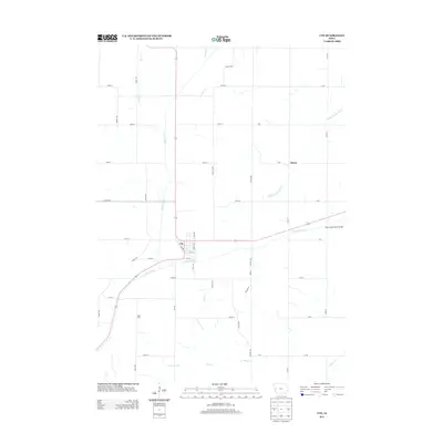
2013 Map of Ute
USGS Topo · Published 2013About this map
The town of Ute serves as the central hub of this Monona County landscape, situated at the confluence of several vital watercourses. The drainage patterns of the Soldier River and its branches, including the E Soldier River and Middle Soldier River, dictate the layout of the local road network. A structured grid of section-line roads, such as 170th St and Sumac Ave, facilitates agricultural movement between small outlying settlements like Berne to the northeast and Saint Clair to the southwest.
Find a feature on this map
49 named features on this map. Tap any name to fly to it.
Don’t see what you’re looking for? This feature index may not catch every label — zoom into the map to look around manually.
Map Details
Editions of this 2013 Ute Map
This is the sole edition of this map. No revisions or reprints were ever made.
Other maps of this area

1954 · Omaha
USGS Topo · 1:250,000

1954 · Fort Dodge
USGS Topo · 1:250,000

1957 · Omaha
USGS Topo · 1:250,000

1957 · Fort Dodge
USGS Topo · 1:250,000

1958 · Omaha
USGS Topo · 1:250,000

1958 · Fort Dodge
USGS Topo · 1:250,000

1969 · Danbury
USGS Topo · 1:24,000

1969 · Mapleton
USGS Topo · 1:24,000
1971 · Mapleton SE
USGS Topo · 1:24,000

1971 · Ricketts
USGS Topo · 1:24,000