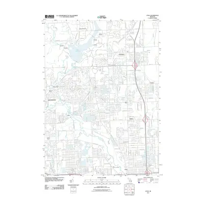
2011 Map of Utica
USGS Topo · Published 2011About this map
The Clinton River and its multiple branches, including the Middle Branch Clinton River, anchor this detailed survey of Macomb County as the suburban landscape of the early 21st century matures. Significant water features like Stony Creek Lake and Winkler Pond define the northern terrain near Mount Vernon, while the southern reaches center on the established communities of Utica and Shelby. Genealogists and local historians will find several well-documented burial sites across the township, including Washington Cemetery, Curtis Cemetery, and the Prestonville Cemetery to the east. The map captures the intersection of traditional settlements like Disco and Stony Creek with modern residential developments and parklands, such as the White Pine Picnic Area. A complex network of drainage systems, including McClure Drain and Disco Drain, illustrates the managed hydrology of this developed corridor between Rochester and the expanding northern suburbs.
Find a feature on this map
98 named features on this map. Tap any name to fly to it.
Don’t see what you’re looking for? This feature index may not catch every label — zoom into the map to look around manually.
Map Details
Editions of this 2011 Utica Map
This is the sole edition of this map. No revisions or reprints were ever made.
Other maps of this area

1908 · Rochester
USGS Topo · 1:62,500

1912 · Mt Clemens
USGS Topo · 1:62,500

1914 · Armada
USGS Topo · 1:62,500

1928 · Armada
USGS Topo · 1:62,500

1929 · Mt Clemens
USGS Topo · 1:62,500

1936 · Warren
USGS Topo · 1:31,680

1936 · Birmingham
USGS Topo · 1:31,680

1936 · Rochester
USGS Topo · 1:31,680

1936 · Washington
USGS Topo · 1:31,680

1936 · Waldenburg
USGS Topo · 1:31,680
Featured Places
- Sterling Heights, MI
- Shelby Charter Township, MI
- Rochester Hills, MI
- Washington Charter Township, MI
- Oakland Charter Township, MI