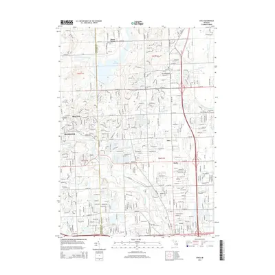
2014 Map of Utica
USGS Topo · Published 2014About this map
Stony Creek Lake and the winding course of the Clinton River define the suburban landscape north of Detroit in the early 21st century. The map illustrates a densely developed corridor where the historic settlements of Utica, Rochester, and Washington have expanded into the surrounding townships. Traces of the area's agricultural and industrial past remain visible through features like the Old Canal near Yates and the numerous small drains, such as McClure Drain and Cannon Drain, that once managed the regional hydrology. For genealogists, the map is particularly rich with burial sites, documenting local history at Stony Creek Cem, Van Hoosen Jones Cem, and the Mt Vernon Cem in the northern reaches. The transition from the more structured grid of Shelby to the rolling terrain near Stony Creek highlights the varying character of Macomb and Oakland counties.
Find a feature on this map
66 named features on this map. Tap any name to fly to it.
Don’t see what you’re looking for? This feature index may not catch every label — zoom into the map to look around manually.
Map Details
Editions of this 2014 Utica Map
This is the sole edition of this map. No revisions or reprints were ever made.
Other maps of this area

1908 · Rochester
USGS Topo · 1:62,500

1912 · Mt Clemens
USGS Topo · 1:62,500

1914 · Armada
USGS Topo · 1:62,500

1928 · Armada
USGS Topo · 1:62,500

1929 · Mt Clemens
USGS Topo · 1:62,500

1936 · Warren
USGS Topo · 1:31,680

1936 · Birmingham
USGS Topo · 1:31,680

1936 · Rochester
USGS Topo · 1:31,680

1936 · Washington
USGS Topo · 1:31,680

1936 · Waldenburg
USGS Topo · 1:31,680
Featured Places
- Sterling Heights, MI
- Shelby Charter Township, MI
- Rochester Hills, MI
- Washington Charter Township, MI
- Oakland Charter Township, MI