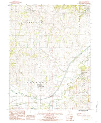
1984 Map of Utica West
USGS Topo · Published 1985About this map
Mooresville and Utica anchor the northern landscape of this Missouri territory, where the topography transitions from the northern uplands down toward the broad floodplain of Shoal Creek. The river system defines the southern half of the map, with Mud Creek, Clear Creek, and Rattlesnake Creek draining into the main channel. Settlement patterns follow the rail lines and higher ground, notably at Dawn and Ludlow, while Dawn Station suggests a specific rail-oriented historical development. Significant elevation markers like Shale Hill in the north and the prominent Blue Mound in the southeast provide a sense of the undulating terrain. Several unnamed Cem sites are noted near the townships, offering valuable points of reference for genealogical research in Livingston County during the early 1980s.
Find a feature on this map
16 named features on this map. Tap any name to fly to it.
Don’t see what you’re looking for? This feature index may not catch every label — zoom into the map to look around manually.
Map Details
Editions of this 1984 Utica West Map
This is the sole edition of this map. No revisions or reprints were ever made.
Other maps of this area

1921 · Chillicothe
USGS Topo · 1:62,500

1922 · Gallatin
USGS Topo · 1:62,500

1923 · Chillicothe
USGS Topo · 1:62,500

1924 · Dawn
USGS Topo · 1:62,500

1924 · Braymer
USGS Topo · 1:62,500

1950 · Coloma
USGS Topo · 1:24,000

1950 · Plymouth
USGS Topo · 1:24,000

1951 · Utica
USGS Topo · 1:62,500

1953 · Moberly
USGS Topo · 1:250,000

1954 · Moberly
USGS Topo · 1:250,000