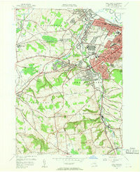
1955 Map of Utica West
USGS Topo · Published 1957About this map
The industrial and institutional landscape of Utica and its western suburbs dominates this 1955 survey, highlighting a region defined by its textile heritage and medical centers. The sprawling grounds of the Utica State Hospital and several major medical facilities like Faxton Hospital and St Elizabeth Hospital anchor the urban core, while the villages of New York Mills and Yorkville follow the winding course of Sauquoit Creek. The rail infrastructure is extensive, featuring the New York Central and the Delaware Lackawanna and Western lines which historically fueled the area's growth.
Find a feature on this map
77 named features on this map. Tap any name to fly to it.
Don’t see what you’re looking for? This feature index may not catch every label — zoom into the map to look around manually.
Map Details
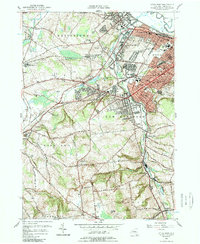
Editions of this 1955 Utica West Map
2 editions found
Other maps of this area

1895 · Oriskany
USGS Topo · 1:62,500

1898 · Utica
USGS Topo · 1:62,500

1898 · Oriskany
USGS Topo · 1:62,500

1900 · Utica
USGS Topo · 1:62,500

1907 · Winfield
USGS Topo · 1:62,500

1907 · Sangerfield
USGS Topo · 1:62,500

1943 · Utica East
USGS Topo · 1:24,000

1943 · Cassville
USGS Topo · 1:24,000

1943 · Sangerfield
USGS Topo · 1:62,500
1943 · West Winfield
USGS Topo · 1:24,000