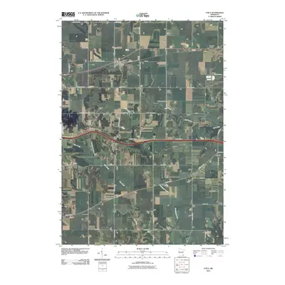
2010 Map of Utica
USGS Topo · Published 2010About this map
Utica serves as a focal point for this section of Winona County, centered on the intersection of Saint Charles Ave and E Main St where the Utica Post Office is located. The surrounding landscape is defined by its agricultural grid and the drainage systems of Rush Creek and Pine Creek, which wind through the township boundaries. A distinct topographic rise at Shelton Hill stands out from the generally level terrain, while the small settlement of Clyde occupies the southwestern portion of the sheet. For those tracing local heritage, several burial grounds are distributed across the countryside, including Saint John Cemetery near the northern border and the Scottish Cemetery to the south. The mapping reflects a late twentieth and early twenty-first-century infrastructure, with the modern paths of County Hwy-14 and County Hwy-6 cutting across the historical township lines.
Find a feature on this map
47 named features on this map. Tap any name to fly to it.
Don’t see what you’re looking for? This feature index may not catch every label — zoom into the map to look around manually.
Map Details
Editions of this 2010 Utica Map
This is the sole edition of this map. No revisions or reprints were ever made.
Other maps of this area

1932 · Cochrane
USGS Topo · 1:62,500

1934 · Plainview
USGS Topo · 1:62,500

1934 · Cochrane
USGS Topo · 1:62,500

1937 · Cochrane
USGS Topo · 1:62,500

1938 · Plainview
USGS Topo · 1:62,500

1953 · Saint Paul
USGS Topo · 1:250,000

1953 · Eau Claire
USGS Topo · 1:250,000

1954 · Chatfield
USGS Topo · 1:62,500

1954 · Lewiston
USGS Topo · 1:62,500

1954 · Mason City
USGS Topo · 1:250,000