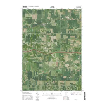
2016 Map of Utica
USGS Topo · Published 2016About this map
Utica and the western edge of Lewiston anchor this Winona County landscape, where the CP railroad follows a corridor established by early transport lines through the prairie and valley terrain. The map captures a transition from the elevated plains near Shelton Hill to the dissected valleys of the southern section, notably around Ferguson Valley. Local history is preserved through several family and community burial grounds, including Saint John Cem, Mount Auburn Cem, and the Scottish Cem located near the southern boundary. These sites, along with small settlements like Fremont and Clyde, reflect the agricultural settlement patterns of southeastern Minnesota. The drainage network is defined by Rush Cr, Pine Cr, and Hemingway Cr, which carve through the undulating topography that characterizes this region of the state.
Find a feature on this map
99 named features on this map. Tap any name to fly to it.
Don’t see what you’re looking for? This feature index may not catch every label — zoom into the map to look around manually.
Map Details
Editions of this 2016 Utica Map
This is the sole edition of this map. No revisions or reprints were ever made.
Other maps of this area

1932 · Cochrane
USGS Topo · 1:62,500

1934 · Plainview
USGS Topo · 1:62,500

1934 · Cochrane
USGS Topo · 1:62,500

1937 · Cochrane
USGS Topo · 1:62,500

1938 · Plainview
USGS Topo · 1:62,500

1953 · Saint Paul
USGS Topo · 1:250,000

1953 · Eau Claire
USGS Topo · 1:250,000

1954 · Chatfield
USGS Topo · 1:62,500

1954 · Lewiston
USGS Topo · 1:62,500

1954 · Mason City
USGS Topo · 1:250,000