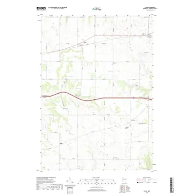
2019 Map of Utica
USGS Topo · Published 2019About this map
Utica and Lewiston anchor the northern landscape of this Winona County region, where the organized grid of the Public Land Survey System meets the natural drainage patterns of Rush Cr and Pine Cr. This modern 2019 survey documents the transition from the rolling highlands of Shelton Hill to the fertile agricultural stretches of Ferguson Valley in the southeast. Genealogists and local historians can pinpoint several significant burial grounds, including the Scottish Cem in the southern township and Saint John Cem on the edge of Lewiston. The settlement of Fremont serves as a central waypoint in the southern half, while Clyde marks the southwestern reach. The map's detailed road network, from Utica Town Rd 8 to Rupprechts Valley Rd, illustrates the enduring rural infrastructure that connects these small communities and their family farms.
Find a feature on this map
69 named features on this map. Tap any name to fly to it.
Don’t see what you’re looking for? This feature index may not catch every label — zoom into the map to look around manually.
Map Details
Editions of this 2019 Utica Map
This is the sole edition of this map. No revisions or reprints were ever made.
Other maps of this area

1932 · Cochrane
USGS Topo · 1:62,500

1934 · Plainview
USGS Topo · 1:62,500

1934 · Cochrane
USGS Topo · 1:62,500

1937 · Cochrane
USGS Topo · 1:62,500

1938 · Plainview
USGS Topo · 1:62,500

1953 · Saint Paul
USGS Topo · 1:250,000

1953 · Eau Claire
USGS Topo · 1:250,000

1954 · Chatfield
USGS Topo · 1:62,500

1954 · Lewiston
USGS Topo · 1:62,500

1954 · Mason City
USGS Topo · 1:250,000